Westwater Canyon is carved by the Colorado River through the desert of the eastern Colorado Plateau. The Colorado Plateau spans a large area surrounding the intersection of the borders of Colorado, Utah, New Mexico, and Arizona and is flush with numerous geographic wonders. The basement rock in the heart of the canyon reveals exposed black granite from the Proterzoic era; rock 1.75 billion years old found in few places on the Colorado River outside of the Grand Canyon. The upper canyon is composed of sandstone. Bring your geologist friends and let them gush effusively over the impressive unconformities and textbook examples of geologic uplift as you float through this remarkable desert canyon.
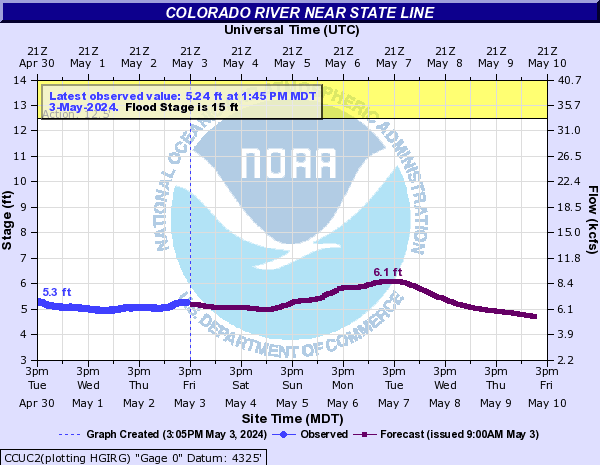
The season for Westwater is long, only shutting down when impassible ice ledges form in the winter. However, in many years the canyon is runnable in December and as early as February or March. Flow ranges are equally accommodating. During the spring runoff, it’s not uncommon for people to do this run with 15,000 cfs or more, but common base flows are in the 2000-6000 cfs range. Kayakers tend to prefer the lower flows in order to enjoy numerous play waves, while rafters find that swilling beer and playing bocce ball are activities available at any flow.
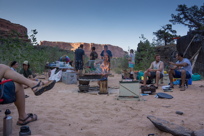
While Westwater isn’t known for its whitewater (only about a mile or two of the canyon has significant whitewater), its high volume can be intimidating to many rafters and novice kayakers, and high flows have led to flush drownings. In the summer, the water and desert milieu make swimming in the water at least as pleasurable as boating on top of it. The scenery through this area is both unique and splendid. Numerous quality campsites abutting stunning desert canyon walls are available.
I once joked with a friend as we headed out on a Westwater trip, that for some reason, significant carnage always arises on Westwater trips. He said he never noticed that, but by the end of the trip, as we were all shelling out an extra 100 bucks to cover the “damages”, he had to admit conceit.
Note that this is a permitted run operated by the BLM. Both day and overnight permits are available, but can be difficult to obtain. Permits become available 2 months prior to the launch date. Visit the BLM website for details. The run starts at the Westwater Ranger station (formerly the town of Westwater). The ranger lives in the building at the put-in and enforces strict “quiet time” rules at night, a recipe intent on failure: send multiple groups of rafters and kayakers from an 8 hour radius for a weekend of fun to a small crowded camping ground to kick off a trip and tell them to stay quiet. The rangers tend to be very strict about regulations, so make sure all your permits and gear are in order and check in early to procure the best campsites.
Westwater, especially when done as an overnight trip, can seem like a lot of effort for a mere two day trip, but as you near the takeout with the sun setting and the canyon walls receding behind you, that’s usually the furthest thought from your mind.
| KSC | |
| Class | III to IV |
| Current Flow |
1880.0 CFS 01-20-2026 17:45 
View River Forecast |
| Recommended Flow |
Minimum: 1000.0 Average: 8000.0 Maximum: 16000.0 |
| Typical Season |
Begins: January Ends: December |
| Recommended Use |
Kayaking: Yes Rafting: Yes Canoeing: Yes SUP: No Packrafting: No Fishing: No |
| Primary Gauge | COLORADO RIVER NEAR COLORADO-UTAH STATE LINE |
| Length | 17.0 Mile(s) |
| Gradient | 10.0 FPM |

Lower Little D Campsite
08-25-2012 -
Photo By: Kevin Cripps