
Saint Vrain, South Fork
Colorado – US
Description
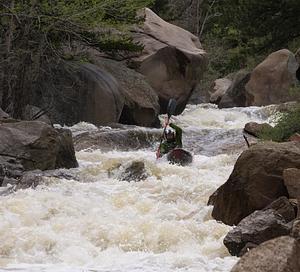
This is a very steep creek that has roadside access for most of the run. Class V boating only here folks.
An active gauge does not exist for this branch, but a good estimate can be obtained by subtracting the Lyons gauge from the north fork. There is a foot gauge on SSV (visual only) located on the upstream south side of the bridge at 4th Ave and Prospect. See the SSV - Confluence to Picnic Grounds run description for additional details.
Photos
| Run | Class | Length | Current flow | Status |
|---|---|---|---|---|
| SSV - Confluence to Picnic Grounds | V to V+ | 5 Mile(s) |
18
CFS
@ Oct 11, 4:50 AM UTC
|
Too Low |